Is it possible to get screen shots to compare completeness of soundings?
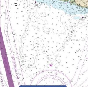
I noticed that my friends Navionics APP had many more contour lines vs my preloaded charts. I have only selected this area because I know it well.
Here is a PDF chart
http://www.charts.noaa.gov/OnLineViewer/18473.shtml
Here is a PDF of the specific area and screen shot of smaller area of the area where I saw the contour lines in the Navionics APP https://johnssportinggoods.com/wp-conte ... -Drift.pdf