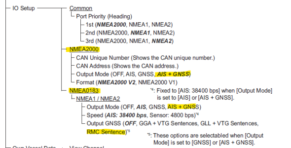
Greetings ! I have two NavNet3D chart plotters and a networked display running TZ Navigation s/w as well as a FA70 AIS. Everything works great. My question: can the dedicated FA70 GPS info be used as a secondary Navigation GPS source for the chartplotters and networked Nav display should my primary GPS fail? I like redundancy as we are crossing the Atlantic in a year. It appears the FA70 is directly connected to the computer via a NMEA0183 to 2000 converter and the AIS info is distributed to the NAVNet3D chart plotters via 2000. Thoughts? Thx ! Ken
FA-70 AIS
- Thread starter KenK
- Start date


