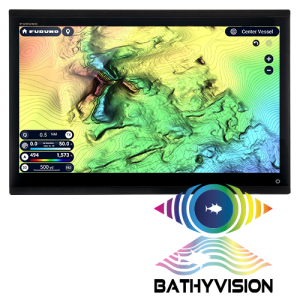
Bathyvision Service Area

LordoftheTides

New member
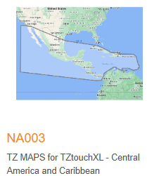
Does anyone have knowledge of Gulf of America/Mexico Bathyvision coverage for TZX in the TZ Central America & Caribbean chart package?
It does not appear that there is much bathymetric data available for FL West Coast.

Thanks
 
The packages are not the same coverage areas that C-map uses. The TZ Maps Central America and Caribbean package doesn't cover Florida.
1742831059749.png
 
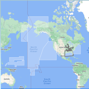
I am not speaking to the CMAP coverage - What I am curious about is how much bottom mapping the bathyvision covers from FL west coast up to Texas. I am just seeing the USA chart has the Gulf of America "coverage" but as mentioned - how much of that has the 3" bathymetry? If it is all covered, I would not need to run PBG DFF3d module
 
My predicament with re-fitting my center console is transducer selection with the ability to run PBG.

A combo transducer like the 165T-PM542LHW does not have a narrow enough beam in HF for my liking.. Fishing often in 90-300ft of water, I want to know more so whats underneath me vs off to the sides when I'm spinning my boat around to anchor. This way, I know those fish are right underneath me from my reading. I believe the 455T-PR903 455khz side scan will be invaluable as to what's to the sides of me. Correct me if I'm wrong but it seems these wide beam transducer combos are meant as a swiss army knife but don't necessarily lead the pack in sidescan / bottom capability?

I often fish 600-2000 ft as well so it is a lot of basis to cover in a 36' center console... Hence if the Bathyvision covers most of where I fish, I'm not sure I'll need PBG.... BUT I WANT IT ALL! HA.

My plan was to run a TZX 16 with the 455T-PR903 for dedicated sidescan, R509LH to a DFF3-UHD box. Then I guess if I want PBG, I'll have to bring out the wallet. I'll need a DFF3D box along with a 165T/275LHW? I currently have a B260 (everyone who bottom fishes < 300 ft should have this ducer).. Maybe if I do PBG with multibeam / DFF3D, I integrate a new FV-800 into the mix to dedicate it's use to sidescan or the R509... Or both?

A lot here to unpack but I appreciate your knowledge and efforts in this high-tech world I'm entering in.
At the end of the day, I'm just a fisherman!
 
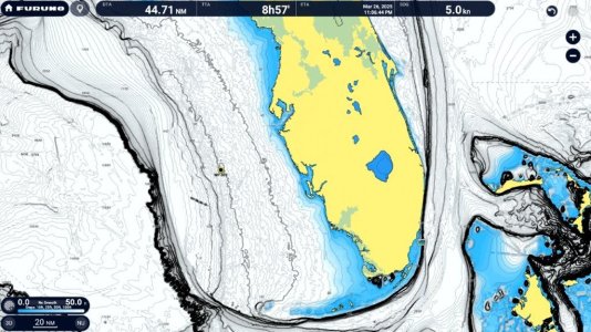
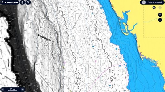
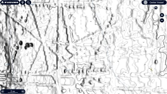
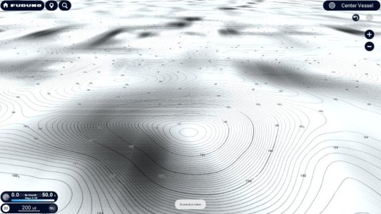
You can't beat real PBG data because slit moves with currents/tides. TZ Mapping for the USA covers three times the area as others for the same or lower initial cost while providing an unheard of update price of $20. No matter what, you get your monies worth when buying the USA TZ Map on XL. Here are some shots from the west coast of FL where you were asking. I am not a big fan of the changes they made to the Terrain Shading in the current version of software. We have asked they look into changing that back where the shading looked more natural. The bathy data varies but many areas you can see changes as low as every three inches. But reality is stuff changes slightly and moves. If you have PBG, I would definitely use it.
 

Attachments

  • TZTXScreen_2025_03_26_14_10_10.jpg
    TZTXScreen_2025_03_26_14_10_10.jpg
    165.7 KB · Views: 10
  • TZTXScreen_2025_03_27_09_55_06.jpg
    TZTXScreen_2025_03_27_09_55_06.jpg
    144.6 KB · Views: 8
  • TZTXScreen_2025_03_27_09_56_07.jpg
    TZTXScreen_2025_03_27_09_56_07.jpg
    143.6 KB · Views: 8
  • TZTXScreen_2025_03_27_09_57_16.jpg
    TZTXScreen_2025_03_27_09_57_16.jpg
    126.9 KB · Views: 10
Back
Top