Chart options/questions for TZT3 9F in Canada

SailorDoc

New member
I've read previous threads on charts, but they are either old (pre-Navionics issues) or related to USA charts.

I am interested in chart options/procedures for system in Canada (to be purchased IN Canada)

  1. Are any charts preinstalled/free on TZT3 purchased in Canada?
  2. Which charts are available for British Columbia? I see C-Map... Are there Timezero (TZMAPS?) charts? The charts on "My Timezero" cloud account are definitely better than current C-Map. Are these timezero vector/raster charts available for TZT3? READING LIMITED INFO ON TZT3 LITERATURE, IT SEEMS ONLY MAPMEDIA (Timezero) CHARTS WORK.
  3. Does the mapmedia/timezero chart purchase for West Coast Canada include both vector and raster charts? (The timezero store seems to suggest "yes", but it is ambiguous. Charts on mycloud.timezero include raster where vector is missing.)
  4. If I purchase a new Furuno TZT3, can I purchase mapmedia chart packs WITHOUT purchasing expensive/not-needed Timezero software. (Trying out a 1st-time online purchase of the mapmedia charts currently automatically adds timezero software.)
  5. Are charts purchased updatable for free for a period of time? (It seems 12 months updates.)
  6. IMPORTANTLY: Do charts purchased "expire"? That is, is a regular subscription required to keep charts working (even if not updateable)?
  7. Finally, I have a recently purchased C-MAP microSD chart card I'm using in my old Furuno chartplotter. Can it be used in the TZT3? (I know, it is not up to date, but frankly, neither are "up-to-date" CMAP cards!) [Seems it will not work. Please confirm.]
[FYI: I am VERY on top of what "up-to-date" means for British Columbia charts.... I have latest CHS vector charts with monthly updates.]

On the verge of purchasing...

Thanks for bearing with me.
 
Only base charts/world charts are viewable for Canada out of the box so nothing you can navigate by are preloaded. Unlike NOAA who is paid by the US Taxpayer, Canada hydrographic office is paid by selling its charts. The available charts for Canada are preloaded on the included chart chip but will require a licence to view. For Canada, one would buy a either a HO (Hydrographic Office) chart or a C-map chart licence for the area you plan to navigate, from your Furuno dealer. They will need your System ID from the boat and the area you wish to purchase. Most purchase the C-map version which at the current time also includes the available fishing bathy data unlock licence for the same area as the Navigation map purchased. It is correct that only MM3 map media type charts work in the NN3D, TZT, TZT2, and TZT3 MFDs regardless of original source of the core data. Don't confuse the newer versions of TimeZero software or iboat with the Furuno MFDs as the newer versions of the PC and iOS devices recently introduced a newer type of mapping which the MFDs do not currently support. If you have the correct version of TimeZero software for the PC that includes the cross licencing agreement (Check with Nobeltec support with any questions regarding their software) then the chart purchase can be linked so the single purchase will allow you to run MM3 chart on both systems. Charts do not expire. The version you purchased will remain licenced to you without expiration. No matter how many versions you get behind, you can always upgrade to the newest with one set discounted upgrade price. You do not have to pay for missing years or have to repurchase at full price whenever an existing licence is upgraded. C-map proprietary cards in other mapping formats can not be used. The Furuno MFDs use MM3 charts on a standard off the shelf card without special formatting. It is always best to run any questions you are unsure of by your Furuno dealer or tech support before purchase. Tech support can provide you some sample screen captures for your area if opening a case and providing a Lat/Lon of your area of concern.
 
Thanks for answers!

Still confused about charts... too bad no website provides enough info.

WHAT IS A "HO" chart? Is it a package? In Canada, does this mean the equivalent of charts from CHS? Vector only or combo of both vector and raster?

Are the CMAP charts available for TZT3 essentially the same as those for other systems? (If "yes" , then easy to investigate online using CMAP chartviewer. If "no", then how does one investigate? (Getting a sample screen shot for a lat/lon is helpful but only one location.)

The nearest Furuno dealer is 2 hours drive away, so not so easy. Hence relying on internet (and wish more info available on web).

Nevertheless, I am impressed with the Furuno support I've seen (and received) on this Forum AND tech support. One reason I am lookingvto stay with Furuno.
 
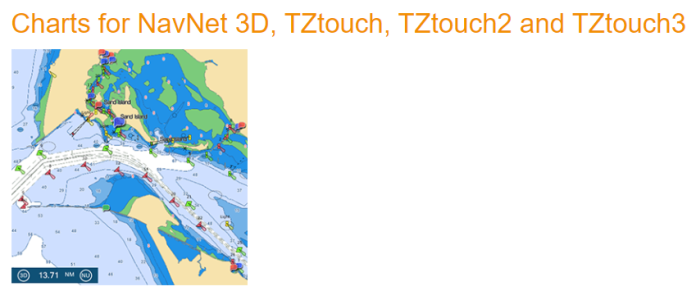
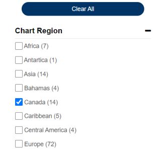
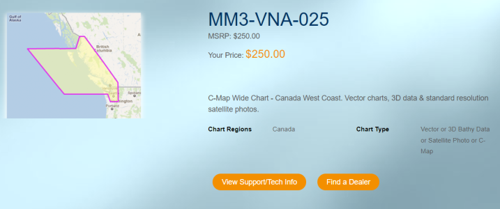
HO (Hydrographic Office) means the source of the data comes from the National Hydrographic Office responsible for that particular area. In the case of Canada, that means the Canada Hydrographic source data is used in creating the MapMedia MM3 chart. Areas of coverage are shown by looking at the Furuno USA website under the MM3 charts. (Look under discover products, browse all products)
1703608824879.png
1703608900914.png
1703608950116.png
Regardless if the dealer is two hours away, if they are making the sale; they should talk to you about your individual needs. Short of that, individual requirements can be discussed directly by calling tech support.
 
Following up:
My question regarding C-MAP updating wasn't quite answered.

Q: If I purchase C-Map MM3-VNA-025 today, am I able to update free for any period of time (e.g., for 12 months from purchase), or only the 1 time I download and unlock charts?

(I'd like to purchase now, but want the most up-to-date C-Map version when my cruise begins late May.)
 
If a newer version is released within 30 days of purchase, you are entitled to a free update. I would recommend not to purchase until you are going to be closer to needing the data. Later down the road the following year or years down the road the chart can be updated at half the normal purchase cost.
 
Back
Top