Vector chart area information

danderer

Furuno Fan
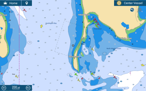
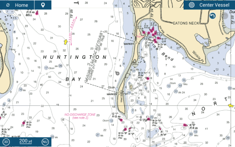
Attached are the vector and raster representations of a measured mile course. How do I get the full information about the area from the vector chart?

Tapping on the area or boundries doesn't yield anything. Tapping on the marks that define the area tells me they are marks for a measured area but nothing more.

More generally, what part of displayed areas do you tap on to get their associated information?
 

Attachments

  • TZT3Screen_2025_06_20_08_41_24.png
    TZT3Screen_2025_06_20_08_41_24.png
    347.4 KB · Views: 6
  • TZT3Screen_2025_06_20_08_41_39.png
    TZT3Screen_2025_06_20_08_41_39.png
    709.7 KB · Views: 6
For marked boundary areas, touch the boundary line normally you get a pop up (which you might need to scroll up or down on to see the selection) for Chart object and Chart info. Raster charts have no interactive option(s) other than you can likely get chart info on the map your looking at.
 
Last I looked, the northern marker for that measured 1/2 mile course was missing. Makes it kind of hard to use.
 
In the US, measured mile courses are mostly forgotten military history. Perhaps there is some interesting reading in the one you have there?

Here in Penobscot bay, there was a course, but the towers are long gone, wrecked in winter storms on the islands, and the land based interior ones disassembled.. It had two towers on land, perhaps half a mile or a mile apart, and you lined up with them, and proceeded to the next pair of towers, and when they lined up, you'd completed the distance. I'm not sure how you'd accurately make use of a course with only two towers.
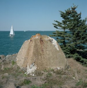
The navy used ours from the late 1800's to the 1950's. I don't know what ended the need for measured miles, perhaps Loran then GPS, or a lack of need for ship building after WWII. This tower base is on Monroe Island. There was another tower on Sheep island to the south, and two towers on the land atop hills.
 

Attachments

  • 22808115414_930c6d44f4_c.jpg
    22808115414_930c6d44f4_c.jpg
    195.8 KB · Views: 2
Any chart concerns can be reported to MapMedia which is normally very responsive. Knowing how to use the built in built-in measuring tool and the boundary line feature, it is possible to have any measurement wanted even if it isn't provided.
 
Back
Top