DeepSouthTX
Furuno Fan
Question for the moderators.
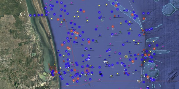
Please see attached screenshot of my timezero cloud for my fishing area. Is there a way to dsiplay this satellite info for the gulf on my TZT3? Interested in the areas offshore as they do not display on my TZT3. Only the coastal inland satellite photo is displayed on my plotter not the offshore fishing areas and bottom in blue on the screenshot. Wondering if there is a chart that I can download that will show the ocean bottom contours like I see online? Thank you.
Please see attached screenshot of my timezero cloud for my fishing area. Is there a way to dsiplay this satellite info for the gulf on my TZT3? Interested in the areas offshore as they do not display on my TZT3. Only the coastal inland satellite photo is displayed on my plotter not the offshore fishing areas and bottom in blue on the screenshot. Wondering if there is a chart that I can download that will show the ocean bottom contours like I see online? Thank you.


