Tzt10x charts

Banyan Wren

New member
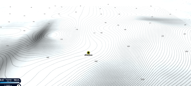
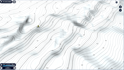
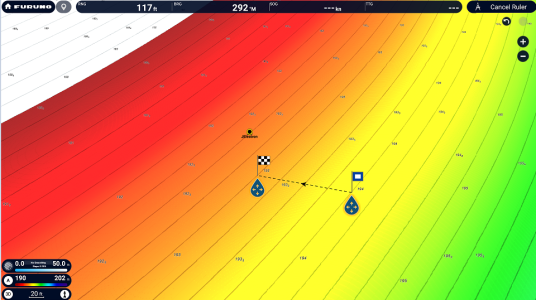
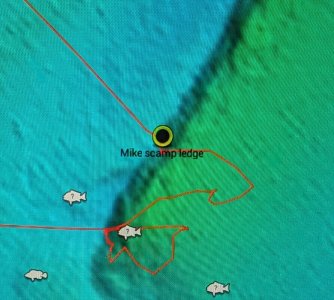
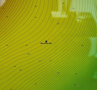
Hey guys. First pic is cmor on my tzt3. Second pic is what I got on my tzt10x. Same spot. Thought this thing was supposed to have high res bathymetry? I bought tzmaps and called timezero. Guy groaned and said call Furuno. Figured I'd post here first as I could include pics and maybe this is what it's *supposed* to look like. Lol I hope not


1000046955.jpg1000046954.jpg
 
You don't have your TZ Maps settings correct. You have too much smoothing, detail is not set high enough or bathy vision not on. I highly recommend some time with the manual because there are a ton of new settings relating to TZ Maps. What is the Lat/lon?
 
I've caught way too many fish off that guy to post numbers on public forum 😂. I'll send them to you via pm. If you could send over a pic of what it should look like when I get everything loaded up and settings correct that would be immensely helpful!
 
Oh well. Can't have anything nice these days 😉

Here's the numbers:
N xxxxxxxx
W xxxxxxxx
 
Last edited by a moderator:
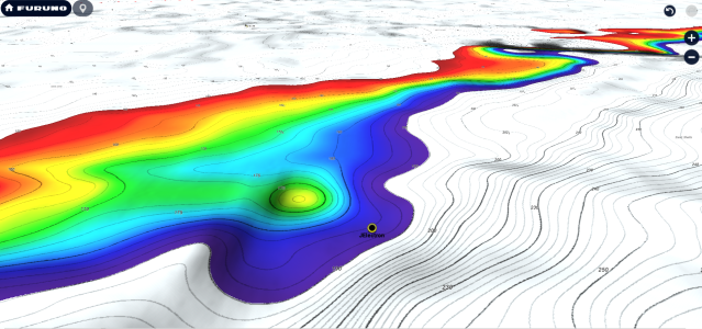
Very interesting area. The carolinas has always been a tricky area. I will send post some photos here to explain but CMOR is like a shaded bathy photo. I will send you more that shows detailed Lat/Lon under PM so to not give too much away to others about where you like to fish. TZ Maps can look very similar depending on the area but CMOR still has it place for the things it does well and not so well. The TZ Maps is extremely scalable and allows you to determine exact depths down to a little as every three inches of change. If your TZT3 (using CMOR) is connected to your XL and same boat system, it is also possible to load the CMOR chart on your XL and view it. It is great that you have the best of both worlds. The coverage of TZ Maps (ALL USA) for the price that only one coast normally costs, with other prior systems, makes it a smoking value for what it offers. The bathyvision takes a bit to get used to due to all the settings and because it is totally different than CMOR, it will look different at first glance in some areas and others it will look almost the same. Time hasn't been my friend this week so I will pick up on this thread with more later on but I am really glad you provided this example because it is very interesting.
 
Very interesting area. The carolinas has always been a tricky area. I will send post some photos here to explain but CMOR is like a shaded bathy photo. I will send you more that shows detailed Lat/Lon under PM so to not give too much away to others about where you like to fish. TZ Maps can look very similar depending on the area but CMOR still has it place for the things it does well and not so well. The TZ Maps is extremely scalable and allows you to determine exact depths down to a little as every three inches of change. If your TZT3 (using CMOR) is connected to your XL and same boat system, it is also possible to load the CMOR chart on your XL and view it. It is great that you have the best of both worlds. The coverage of TZ Maps (ALL USA) for the price that only one coast normally costs, with other prior systems, makes it a smoking value for what it offers. The bathyvision takes a bit to get used to due to all the settings and because it is totally different than CMOR, it will look different at first glance in some areas and others it will look almost the same. Time hasn't been my friend this week so I will pick up on this thread with more later on but I am really glad you provided this example because it is very interesting.

When possible I would definitely appreciate it if you could post photos/pm me what those numbers should be looking like on my xl. Thanks!
 
Had a marine electronics professional that's very familiar with Furuno (not with tztxl's though, unfortunately) come by last week. He and I spent almost 2 hours on the phone with Furuno tech support but I still don't appear to have the data I'm supposed to have showing on the new XL (screen looks the same as above still). Furuno tech (Chris I believe) said to wait and see what you sent over regarding what the bathymetry *should* look like. Little help please.
 
The cmor pic is there for reference to show what is actually in that location (I have fished that ledge multiple times and can confirm the cmor is completely accurate and that is a 6'+ ledge). The tztxl shows no ledge of any sort.

The question is why not? Either the data is not there/available from Furuno/tzmaps or I have something set up wrong. If you could post a pic of what it looks like on a known-properly-setup machine that would be most helpful so I know if the issue is on my end or in the source data itself.
 
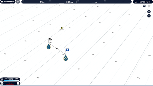
I don't think you have it setup wrong but maybe not looking at it as a line bathy chart. This is something I would like to dig into more but don't have the time at the moment. While some areas clearly match up almost this one is different. Of all the people, you have the best of all worlds, so not sure why you are in such a rush on this. The CMOR has not depth tied to it. It is a nice looking shaded bathy map without any depth being attached to it. It is not the same as a bathy line chart. There are shaded raised areas as well as depth bathy depth lines that once can follow a ridge. It would be interesting to see someone run DFF3D PBG over that area. I think the depth of what you are seeing in the CMOR photo is not nearly as much of a jump in depth as you might think by the looks of it. The depth changes in that area are not drastic. Taking measurements in 50ft of distance it only drops in inches. The one reflects a roughly 20ft to see a 1 ft drop. While I was going to look at this more, I don't have the time to spend. This is where PBG would add a lot.

1740414485758.png
1740414702088.png
1740414517942.png
1740414761036.png
1740414898834.png
 
I can collect PBG next time I'm out there but I can go ahead and tell you the data above is wrong as I've fished that spot more than a few times and there is a defined ledge there that follows the one in the cmor map where tzmaps is showing basically flat bottom.

Coverage for cmor out of Charleston is pretty bad and I'm interested in exploring the bottom more in the 400-900' depth range which is why I added the tztxl. I love my tzt3's (and my other Furuno gear as well) I just can't stand their maps as they don't give you enough info to even begin prospecting. I'm not sure where to go from here if the tzmaps on the new XL is that inaccurate for the areas I'm fishing.

Curious where the data for tzmaps is coming from. I checked another spot I fish regularly in 90' of water where there is an 8-10' tall hump a hundred or so feet long. Presents as a shipwreck but it's ill-defined enough to make me think it has been there for quite a long time. That location also shows as flat ground on tzmaps (not sure if it would be reasonable to expect that to show up as I don't know age of wreck or how long ago source data for tzmaps was collected)
 
Back
Top