Purchased C-map fishing chart not showing on both networked TZT3 screens

WindynParadise

New member
I have a TZT19 and TZT12 networked. I purchased a C-map chart, and downloaded and unlocked the chart on the TZT19 (master). It works great on that screen but doesn't come up on the TZT12. It is on the TZT12 chart plotter as a "fishing" selection choice, but it doesn't pull up the correct chart. I checked that the C-map shows unlocked on the TZT12 and also that the TZT19 is marked as MASTER. Interestingly, when I look at the sync log, it shows the TZT12 as MASTER even though it isn't selected as such on the MFD. Any help please, I have the TZT12 at my second station and need for it to pull up the fishing chart.
 
I think what you are seeing in the sync log is maybe the "Data Master" not the chart master. They are two completely different things. Data master is the unit in charge of talking to the 2000 bus and is the unit that you first turned ON that day. Charts do not share over the network. It is important to ensure that the chart being used is on the chart card of the machine you are trying to view it on. I think something is being overlooked. I would recommend calling into our tech support while at the boat and I am sure they can help you sort it out.
 
I heard from support you found the issue was missing map data on the second machine. Glad to hear they helped get the concern resolved.
 
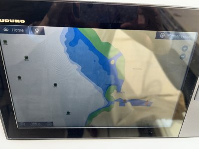
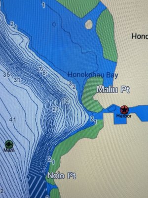
@Johnny Electron I spoke too soon that the problem was solved. I loaded the purchased charts onto the microSD card on the 12 and can see it is unlocked. All good. However, it still doesn’t come up like the 19 does with the depth contours and details. The chart is loaded on both microSD cards, the 2 units are networked together and I see all my waypoints and boundaries on there but no contour detail. What am I missing?
 

Attachments

  • IMG_5285.jpeg
    IMG_5285.jpeg
    2.4 MB · Views: 7
  • IMG_5283.jpeg
    IMG_5283.jpeg
    2.6 MB · Views: 7
Ensure you have the same type selected. If fishing bathy, select FISHING if C-map Navigation chart, select C-MAP. Range is very important as details change as you range in or out. These photos don't seem to even be close to the same range.
 
Back
Top