Chilipepper
New member
I have a navnet1 system set up for c-map charts. All units were purchased at the same time (2002) and installed by the dealer. The set up was as follows: Upper helm - GD1700C
Lower helm - M1722C
Radar Antenna Unit: RSB-110, connected to lower unit via cable with large rectangular plug
GPS - GP320B (Waas) - connected to imput 1 on upper unit
Network Sounder - BBFF1, connected to 12v, 520T-HDP transducer, and ethernet hub
Ethernet hub - connected to 12v, network sounder, GD1700C via network port, and M1722C via network port
This arrangement performed properly, however the Upper helm unit, GD1700C quit working and is being replaced by a larer NavNet1 1900C.
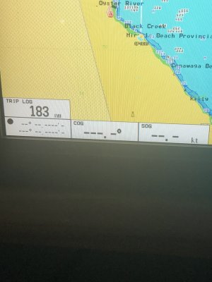
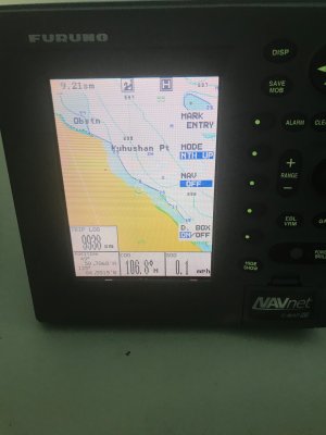
I had to convert this unit from Navionics to C-Map and the folks at Furuno USA were extremely helpful in assisting me getting this done. The new to me 1900C now displays the sounder, radar and GPs Chart. The probem I am encountering is that while the 190C shows the chart and boat position correctly,the data boxes are not displaying any information such as Lat Lon, COG, SOG etc. It seems to be a setting issue as the information is being displayed properly on the M1722C.
Any help would be greatly appreciated


