Most detailed charts for Touch 2? Fishing.

ELGATODOS

Furuno Fan
My old Simrad NSS16 had great built in charts "Insight"

On the FURUNO the stock charts are not that great and I am trying to find the best one for what I do. I need very detailed bottom lines and contours off the coast of San Diego. I also see on my unit as it is there is a huge void for just over the border in Mexico, which is where we fish most of the time.

Any suggestions highly appreciated.
 
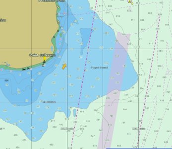
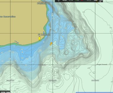
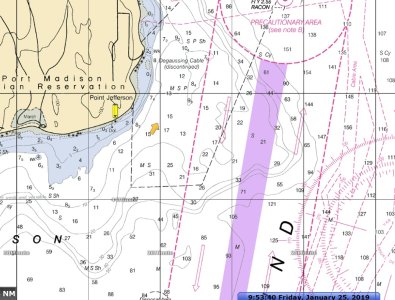
Here is a comparison of a chart in the Seattle area. I would expect the same differences in the San Diego area. These .mm3 for my TZT/TZ Pro 3.3
 

Attachments

  • Jeff Head C-Map.jpg
    Jeff Head C-Map.jpg
    109.5 KB · Views: 1,684
  • Jeff head Fishing.jpg
    Jeff head Fishing.jpg
    214 KB · Views: 1,684
  • Jeff Head Raster.jpg
    Jeff Head Raster.jpg
    208.7 KB · Views: 1,684
So that's one of the charts on the little chip card that comes with the unit and I just need to buy an unlock code? Thanks, Bryan
 
Yes, you should have this chart on you SD card. You would need to pay for the unlock code
SDNA027FISHMAP01.dbb or SDNA024FISHMAP01.dbb

They seem to have an overlap, one has the entire west coast (the 2cnd one) while the first has southern California and the Gulf.
 
Spent the $250 on the chart
Is there a way to use both charts?
The "Auto" charter shows the MLPA closure areas on it, yet when I switch to "fishing" it does not show the closed area?
Why would is be on one and not the other, and especially the "fishing" chart not showing closed fishing areas?
 
It is not possible to show both the MM3 C-map Navigational chart and the MM3 C-map Bathy chart at the same exact time using the same real estate. A quick swipe from the bottom of the screen will allow you to toggle between them quickly but it isn't possible to display them on the same screen page. You can split your screen with the Navigational chart on one side and then put the fishing chart on the other and see them both.
 
Wow that's really a stunner the most important thing for people fishing down in the San Diego region is to stay legal and not cross over in the MLPA yet it's not active as a line on the "fishing" chart. Any way to create solid lines on the plotter to basically create these boundaries on the chart?
 
Back
Top