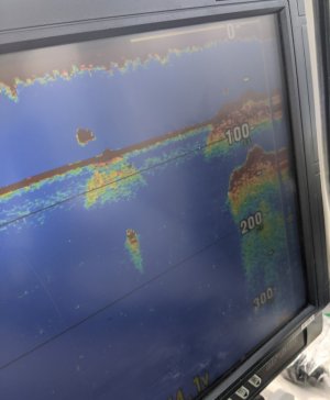
Fish finder images

Sea Monkey

New member
Hello,

I have a TZT3 12F with an Airmar B275LHW transducer. I am new to using electronics and need some help dialing the unit in and determining what I see on the screen. For the time being, I am fishing in Southern California next to the islands, typically in water 200' or less.

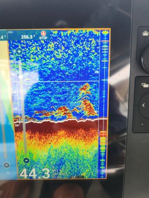
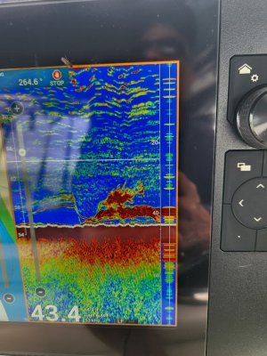
Can you please tell me what I am looking at in the following images?

Are these fish or kelp stringers along the bottom?
20250605_080037.jpg

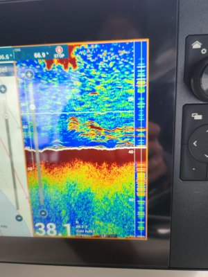
Is this fish along the bottom?
20250605_085346.jpg

Is this a bait school?
20250605_085451.jpg

Is this a rock or bait school with bigger fish going through it?
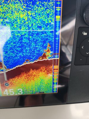
20250605_085228.jpg

I appreciate any help. Should I change any settings on the unit to get a better reading between 20 and 150 feet of water?
 
I too would be grateful of any guidance on settings. I have the 16" version of this MFD and the same transducer. (fish a little deeper though)
Using LF in 38 feet of water may get a comment Sea Monkey.
Thanks in advance.
 
I realized afterward that I had somehow switched back to lf. I thought I had set it to hf at the dock, but that was when the fish finder was on full screen. When it was set to split screen with the chart plotter it was in lf.

Next time I am at the boat, I will fix that.
 
The red arches look like fish. 1749567124391.png

Where are you in the world and were you anchored or moving? Are you expecting to see kelp? Do kelp have large air pockets that look like fish?

For the testing, swipe up on the sounder screen and set to auto fishing until you get comfortable with what you are seeing- then try manual gain and clutter down the road.
Set and leave on the HW unless in much deeper water or for some reason really want the L.

Screenshots
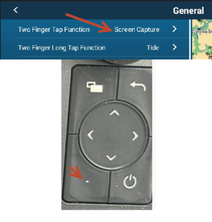
If you already know this, then disregard, but I set up my TZT3 to take a screenshot with the press of one button.( screenshot how to add below)

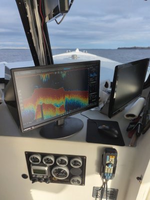
With the data syncing to the cloud via hotspot (on phone) every 10 minutes, by the time I get home, they are all uploaded to the timezero cloud for free and higher quality than via my phone camera. Just sharing the feature in case you don’t use it yet.

If you set up the account here, https://mytimezero.com/tz-cloud , then add that same account to the TZT3- when the TZT3 connects to the internet to sync data, all the screenshots, waypoints, catches uploads to the cloud. So no thumb drive needed. this is a screenshot of what it looks like from home.


1749566802416.png
 
Thank you for the response and information. These photos were taken on the east end of Catalina Island while traveling around 2 knots. There is kelp in the area, but I don't think the air pockets would register as fish.

I am using TimeZero already, so I am going to program the screen shot feature as you have suggested, that will help.

I am curious to know (I won't be able to go back to the boat until next week) are the sounding settings different in each screen setting? I.e, I setup the Sounder in full screen to HF and used the settings recommended on another thread from this site. However, when I opened the split screen that has the Sounder and Chartplotter, the Sounder is in LF and is in auto gain.

Again, thanks for the response it is much appreciated.
 
Back
Top